Nick Culley - 156006

logs 203

Awards Completed

MLW IML ML

Winter Walking Record

Details

Date : 04/02/2017

Duration : 8+ hours

Style : Equals

Type : Quality Mountain Day (QMD)

Weather : Light snow - poor visibility

Wind : Strong wind

Camping Type :

Nights Camping :

Mountains : Blunt Top Blunt Top Broad Crag Broad Crag Scafell Pike Scafell Pike

Flagged :

Description

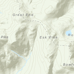
A lengthy summit of Scarfell Pike in very poor visibility. After a dreary slog up the valley visibility reduced dramatically on ascending Rossett Pike. Above 900m strong winds and snow made seeing ones feet a challenge, calling for careful navigation. Hand-railing the How Beck Eastwards, to our delight the weather improved and we became sheltered from the wind enough for a little bit of aerial videography before realising we had a very long and soggy slog back to the car.

Area : Central Fells

South of the A66 and east of the Hardknott Pass as far east as the Kirkstone Pass

Map

MarkerMarker
Leaflet Tiles © Esri — Esri, DeLorme, NAVTEQ, TomTom, Intermap, iPC, USGS, FAO, NPS, NRCAN, GeoBase, Kadaster NL, Ordnance Survey, Esri Japan, METI, Esri China (Hong Kong), and the GIS User Community
Time Taken : 08:11:58.0300000 Distance : 22.78 km Ascent : 1720.13 m Descent : -1738.63 m Avg Speed : 4.4 kmph Moving Speed : 4.4 kmph
Loading