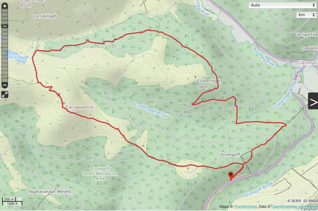
Drumgoff to Kelly’s Lough Loop
Saturday 27th April 2019
13km. Altuitude gain 540m
Four in the group.
Not sure of their ability.
Equipment looked good to Ok and I knew one of them through a friend
First meet up with this group so I picked an easy route and path. A storm and high winds came in the night before and there were still some winds up high.
We had the option to head to Lugnaquilla or turn back above Kelly’s Lough.
As I didn’t know these people I choose to start at Drumgoff just off the road. This was a higher start and cut out the hard climb up the zigzags or out of Fraughan Rock Glen. The route turned out to be a good path with a mixture of forest path, board walk across wet patches and then some open ground. There was a long slow incline over open ground and the wind picked up to make the group a bit slow. Horizontal sleet came in followed by lovely sunny spells. The group showed no enthusiasm for heading to Lug and into higher winds so we dropped to Kelly’s lough for cover and a bite to eat. We headed back through pleasant forestry, a mixture of boardwalk and forest road.
Happy enough that I didn’t drag them up a harder route.
Area :
Wicklow Mountains South
The Wicklow Mountains are the largest area of continuous high ground in Ireland, having an unbroken area of over 500 km2 (190 sq mi) above 300 metres (1000 feet). They occupy the centre of County Wicklow and extend into Counties Dublin, Carlow and Wexford. The general direction of the mountain ranges is from north-east to south-west. The south includes Croghan Kinsella.