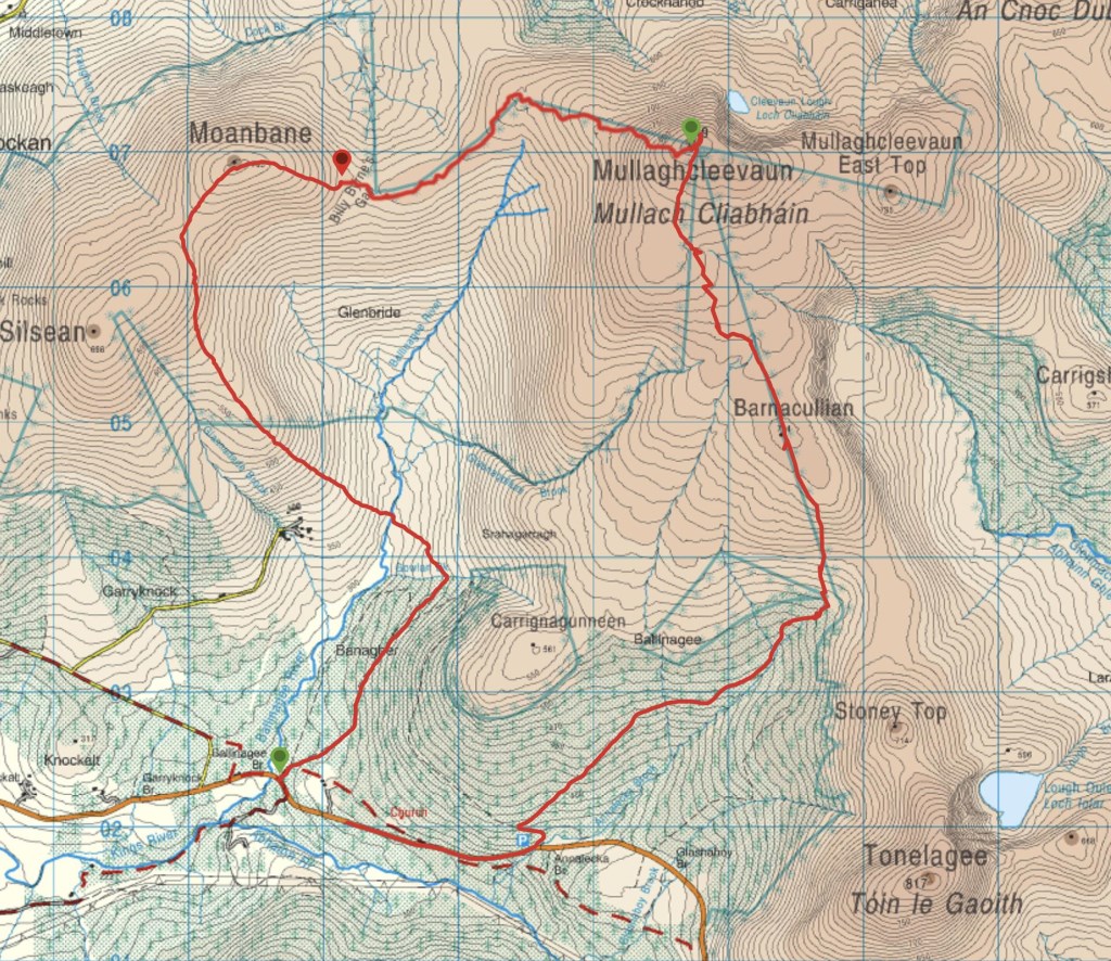
Moanbane, Mullaghcleevaun Barnacullian
16 May
21km
Gain 530m
Out with three people who were sent my way by another ML. The group are preparing for a walking trip to the Alps in August. They are working on fitness.
One has a background in hiking but has done little in years. The other two don’;t hike but they do a bit of cycling. Navigation is not going to be an issue they say so we are concentrating on just planning, food, hydration and establishing what suits each individual. One forgets his boots so its not a great start :-). It has been dry and I’;mm. Familiar with the ground, with any luck we can avoid the ever present bog swill from Mullaghcleevaun to Barnacullin. He has approach shoes and gaiters. Otherwise everyone is well equipped, perhaps carrying too much for this short day. Forest path followed by an easy downhill to a stream was the beginning. Then the uphill began…:-) The slope wasn’t very steep but the pace was slow and there were plenty of stops to discuss the landscape to allow for people to catch their breath. I decided to contour round rather than hit each summit and cut a bit of ascent out off the trip. Once they settled down we developed a bit of rhythm. Moanbane to Mullaghcleevaun was reasonable, the summit was calm and sunny. We began the long descent through the turf hags which were mostly dry. The group enjoyed the deep ravines through the turf formed by the run off from the summit. There was the option to do a longer loop trough Stoney Top and Tonelagee but given the fitness level I though it best to turn for home. WE dropped to the edge of a forest and followed a track to the road and then picked up part of the Wicklow Way back to the cars. We had a bit off a debrief and discussed what their objectives were, multiple days in the Alps in Summer at altitude. How much did they want to enjoy it? A lot…so hike more, be a bit more careful of your diet and build up slowly. A little often.
We will plan a few more days out and see how they progress…hopefully they remember their boots.
Area :
Wicklow Mountains North
The Wicklow Mountains are the largest area of continuous high ground in Ireland, having an unbroken area of over 500 km2 (190 sq mi) above 300 metres (1000 feet). They occupy the centre of County Wicklow and extend into Counties Dublin, Carlow and Wexford. The general direction of the mountain ranges is from north-east to south-west.The north is compromised of Kippure, on the boundary of Dublin and Wicklow.