You have got JavaScript turned off. Many features of this website may not work. Please turn JavaScript on for an optimal experience.
Toggle navigation
Providers
Courses
Workshops
Shop
Contact
Sign-Up
Log in
Dorian Thomas
- 177186
logs
1,011
Awards Completed
ML
Member Of
Details
Records
Schemes
CPD
Files
Referees
Back to List
Scrambling Record
My DLOG
Details
Date :
07/09/2024
Duration :
3-5 hours
Grade :
1
Style :
Instructor / Leader
Type :
Summer Scrambling
Weather :
Clear - sunny - good visibility
Wind :
Gentle breeze
Camping Type :
Nights Camping :
Mountains :
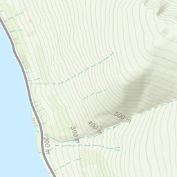
Helvellyn
Striding Edge
Flagged :
Path Taken
Description
Automatically created from a GPX file - 2024-09-07.gpx
Striding and Swiral edges
Area :
Eastern Fells
From the Kirkstone Pass to the M6.
GPX
KML
Map
+
−
Leaflet
|
Tiles © Esri — Esri, DeLorme, NAVTEQ, TomTom, Intermap, iPC, USGS, FAO, NPS, NRCAN, GeoBase, Kadaster NL, Ordnance Survey, Esri Japan, METI, Esri China (Hong Kong), and the GIS User Community
OS Maps are only available to premium members. Click
here
to learn about premium accounts.
Time Taken :
05:55:21
Distance :
12.87 km
Ascent :
1040.6 m
Descent :
-1028 m
Avg Speed :
2.47 kmph
Moving Speed :
2.47 kmph
Elevation (meters)
Speed (km/h)
×
Confirm
Are you sure?
Loading
×
We use cookies to make sure that we give you the best experience possible on our website. Without cookies this website would not function properly.
To understand more about cookies please click here


 Automatically created from a GPX file - 2024-09-07.gpx