Corsica GR20 and Parc Regional Naturel De Corse
Recce`ing a D of E Gold route for Outlook Expeditions for a planned summer school expedition. Walking various sections and legs of the routes risk assessing and determining suitability as well as gathering information such as accommodation options, transport links and associated costs. Walking solo out of season though the weather was generally fine if a little cool. Rough route walked below, though with lots of side paths taken to explore potential escape options/alternative routes. Refuges were out of season so unmanned, wild camped along route or by huts.
Day 1 Corte – Restonica Valley – Bergerie de Cappellaccia - Refuge de la Sega
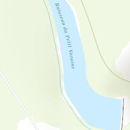
The trek started up the road heading South West out of Corte and was well signposted. The walk initially along the road, though the only traffic is tourists heading up the valley. After passing the Auberge de la Restonica before long a path breaks off from the road by a car park, a little after passing the Auberge de Restonica. This path is well shaded and after a while came to Camping Tuani, where water bottles could be replenished.
Continued along the trail, passing a bridge, and at the second bridge crossed over to join the road and walk along it for a while. Filled water bottles in the river. After a sharp bend in the road, the trail started up on the right, signposted Plateau D’Alzu and Refuge a Sega and is marked by Orange paint. The trail split fairly early on, be sure to take the correct trail heading up hill.
This trail gradually gained height but there were shady patches of trees to take breaks.
A number of Bergeries are along this section of trail, where there was access to water. There are also sign posts for Refuge de la Sega, Vallee de Tavignanu and Calacuccia helping to point the way, as well as “Vente De Fromage” signs indicating that cheese can be bought from the Bergeries.
The path winded NW across the plateau D’Alzo before entering the Foret du Tavignano. Almost immediately upon entering the forest there are some abandoned buildings and some amazing boulder formations. The direction of the trail around here is unclear, had to pay close attention to the map and look carefully for the trail markings which are still present but not so numerous. The path is easy and pleasant down to the Refuge de la Sega which is signposted as you approach.
18.1km, 1450m ascent, 700m descent
Start of the Route – 32 T 051231 468336
Refuge de la Sega – 32 T 050328 468152
Day 2 Refuge de la Sega – Bergerie de Vaccaghia / Refuge de Manganu
The trail was signposted from Refuge de la Sega, to Lac de Ninu and Refuge de Manganu and marked by yellow paint. The trail was easy going through the scenic forest and there were opportunities to refill water bottles. There was a lovely small waterfall and pool at 32 T 0501574 4680478 that shouldn’t be missed. Not long after this the trail headed out of the forest and became more open. There is a little height gain but nothing like the previous day.
There werea couple other places to fill water bottles at 32 T 0501045 4679656 and 32 T 0500830 4679578. From here the trail becomes indistinct and not very well marked, had to pay close attention to the map. At the junction with the trail at 32 T 05006 46796, there is a sign post. Took the path heading South towards Refuge Manganu. The path becomes more obvious again and is easier to follow. As the trail got nearer the Bergerie de Tramizzole there were again places to fill water bottles and soon some woods provided some shade. There was a beautiful spot to relax and fill water bottles where you cross over the river just before coming to the GR20 trail and Bergerie de Vaccaghia. Headed on to Refuge de Managanu, South along the well-marked GR20 trail.
12.5 km, 650m ascent, 210m descent
Refuge de la Sega – 32 T 050328 468152
Refuge de Manganu – 32 T 049838 467418
Day 3 Bergerie de Vaccaghia / Refuge de Manganu – Lac de Nino – Castell di Vergio
Retraced steps towards Bergerie de Vaccaghia and continued along the GR20 heading North West. After the Bergerie the path winded down towards the river where there were some beautiful pools in the river. Continued along the GR20 toward Bergerie Inzecche.
Took a side path up towards Bocca a Stazzona, and down the hill on the other side. Quite scrambly, unsuitable for the proposed D of E route so returned back up to GR20 geading West towards Bocca a Reta. Eventually the trail came to the col at Bocca San Pedru where there was an effigy of Saint Pedru. The GR20 heads North from here into the woods. Gentle walking eventually led to the road and then Hotel Castel di Vergio.
15.1 km, 650m ascent, 850m descent
Refuge de Manganu – 32 T 049838 467418
Castell di Vergio – 32 T 049116 468161
Day 4 Castell di Vergio – Refuge de Tighiettu
From Castel di Vergio headed West along the road for a short while to pick up the GR20 North which descended slightly towards Bergerie de Radule through some shaded woods. Before long you passed the Bergerie de Radule and crossed a bridge to continue North on the GR20 (also signposted Sentier de Transhumance). After 800m there was another bridge and short alternate path,the pool further on was stunning and the river was easily crossed. The Sentier de Transhumance trail veers off West a little after the pool, continued along the GR20 heading North.
Kept along the GR20 which headed up and West to ridge line 1.5 km after the Sentier de Transhumance split off. There were many paths heading up the valley straight to Refuge Ciuttulu di I Mori, the views from the ridge were not to be missed though. The GR20 soon brought me to the Refuge where there was a chance to fill Water bottles. The GR20 continued from the Refuge up to Bocca di Foggiale, and then started to descend on some scrambling ground on rock slabs. The terrain was never technical, but it is quite rocky and there was the occasional short step.
The GR20 crossed some a small stream and pool and descended down to some woods and welcome shade. Continued along the GR20 being mindful not to follow the unmarked trail that headed West along the river, the GR20 gently curved North and passed by some more beautiful pools and streams before eventually emerging by Berg de Vallone then continuing further uphill to Refuge Tighiettu; another kilometre up the GR20.
15.7 km, 1200m ascent, 920m descent
Castell di Vergio – 32 T 049116 468161
Refuge de Tighiettu – 32 T 049246 468999
Day 5 Refuge de Tighiettu - Cirque De Solitude - Refuge de Tighiettu - Lozzi
Up from the refuge to recce the Cirque de Solitude, scrambled to the other side to risk assess the technicalities for IMLs. Chains in place on tricky sections. Reversed back to the hut then back down trails towards Lozzi along straightforward trails then roads.
19.5 km, 1300m ascent, 1050m descent
Monte Cintu Campsite - 32 T 050086 468860
Day 6 Lozzi - Calacuccia - Refuge de la Sega - Mare a Mare Nord - Corte
Back up hill though Calacuccia back up to Refuge de la Sega then down the Mare a Mare Nord trail back to Corte.
16.5 km, 1850m ascent, 500m descent, 9hrs