Myself and a friend set off to camp on Aran Fawddwy, it was to be my friends first wild camp and due to the amount of kit he was carrying we were slower than expected up the ridge line and wanted to be sheltered from the stiff wind blowing, I decided to set up camp lower down, below the summit of Aran Benllyn , this did mean that our distance would not be even over the two days but with the promise of a good weather forecast and our loads lightened by eating our generous provisions . We got set up and had a lovely evening chatting and enjoying the sunset with a beer or two.
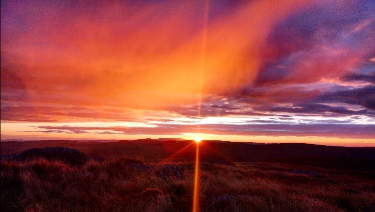
Alarms set for before dawn we were not disappointed by the sunrise, the first for my friend on a mountain.
After breakfast we packed away our camp and had a lovely day taking in the main summit of Aran Fawddwy before a tricky rough tussock filled decent following the flow of a run off into the top of a forest, the going improved at the forest as we joined forest tracks and paths for the walk back through the valley .
Area :
Aran Range
Aran Fawddwy, which is only 9 metres (30 ft) short of being a member of the Welsh 3000s, is the highest peak in the Aran mountain range and the 16th highest summit in Wales. The other two Marilyns in this range are Glasgwm and Esgeiriau Gwynion.[4]
It is the highest British mountain south of Snowdon and is the principal summit of the predominant southwest-northeast ridge between Dolgellau and Bala, southern Snowdonia, a ridge that continues westwards as Cadair Idris.