A tale of 2 very different days,
Overcast but perfect conditions for hiking, as the cloud base was above the summits for all of the first day, the going very easy for the first 7km of walking on very good tracks.
Turning off the stalkers path and making a very steep pathless accent towards the Munro of Beinn a'Chlachair, following the ridge up i got on to the plateau and left my bag to walk to the summit .
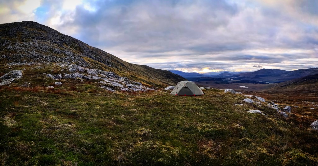
I started looking for a place to camp and there were some lovely spots on the plateau leading down to the bealach, i wanted / needed to be near some water so continued further down to a nice level spot in the bealach with a fast running stream nearby.
I pitched my tent and made dinner ( freeze dried beef hotpot) while watching the amazing sunset, the wind picked up and i settled down for the night.
In the morning I woke to catch the sunrise, here i was disappointed to be inside a cloud with no view what so ever the cloud persisted for pretty much the rest of the day untill i was below 600m . I found the navigation extremely difficult and had to confirm my position a few times with GPS as i had lost my confidence on the featureless terrain approaching Geal Charn , the decent off was easier as there was a rocky outcrop to follow down where i found a stalkers path perpendicular to my direction of travel and a trod heading up to the final summit of Creag Pitridh, the wind picking up all morning, was felt very strongly now.
i made my way off and back to the stalkers path and return to the car .
I am disappointed i had to use technology to give me confidence on my position but happy i had the ablity to do so or i may still be wandering around the mountains now.
Area :
Creag Meagaidh (Loch Lochy To Loch Laggan)
This area includes the famous Creag Meagaidh Range and surrounding peaks of at least 600m. It stretches east of the A82 between Spean Bridge and Invergarry, and north of the A86 as far east as Stob Coire Dubh. There are a large number of impressive winter climbs in Coire Ardair and endless navigation opportunities on and around the high central plateau of Creag Meagaidh itself. The mountains to the north and east of this range are under East Highlands, Monaliadth Mountains.