Whernside and Blea Moor
Total Time: 5 hours 11 minutes; Total Distance: 19.8km; Total Ascent: 1,133m
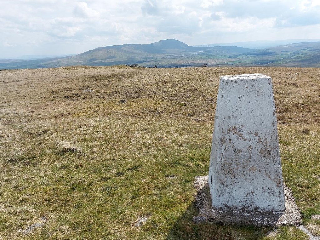
Whernside (736m): Started from the parking lot at Ribblehead, headed north along the Dale High Way (Bridleway) passing the Ribblehead Viaduct and then the Blea Moor Sidings, crossing the rail tracks at the Aqueduct, up Smithy Hill, passing the waterfalls, then turned west, ascending the ridgeline on Whernside to intersect with "A Pennine Journey" (Bridleway), turning south to the Triangulation Point at the summit of Whernside (736m). After a break at the summit, continued south to the turn to the Southwest off of the ridgeline and down into the valley to the intersection of 'A Pennine Journey' and the 'Dale High Way' at Broadrake, turning northeast passing 'The Scar' and then to Winterscales farm, arriving back to the Bleamoor Sidings. This first half of the walk was on major paths/bridleways, as Whernside is the tallest of the Yorkshire Three Peaks and well traveled. As it was a lovely day there were many people on the trails. This portion of the walk took right at 3 hours. Though there was significant altitude gain and loss, the trails were well marked, and dry rocky soil underfoot on bridleway. I did not need a compass at any point on this portion of the walk. I just thumbed the map to observe map features as I went along.
Blea Moor (535m): This portion of the walk took right at 2 hours, and was almost entirely off trail. From Bleamoor Sidings I turned back north to the Aqueduct, but then turned northeast, leaving the trail towards the Air Shafts for the Bleamoor Tunnel. After about 10 days of regular rain fall the ground underfoot (off trail) was marshy in places and running water to cross. The marsh grasses were uneven underfoot. At the first airshaft I took a bearing from the map east at 85 degrees and then followed the bearing up the hill towards the summit. The Blea Moor summit and Triangulation Point were not visible from this starting point. After two false summits and the toping Blea Moor Crag the Trig point became visible and the bearing turned out to be exactly in line, after boxing out a couple of groughs. After making the summit and taking a short break at the trig point, I turned south, there were no trails on Blea Moor, and unlike Whernside that had heavy traffic, I was alone on Blea Moor. Though there was no trail, I could observe a fence line off to my left (east), which I was able to hand rail all the way back to main trail at Ribblehead. The ground was very wet and marshy the entire way back to the hard trail.
Route Planning: was conducted using the OS Explorer OL2 1:25,000 map, and plotted and printed from the Ordnance Survey App on my computer.
Weather: Weather forecasts were collected from The Met Office Mountain Weather for Whernside, and from Accuweather, and BBC Weather. After having spent the past week on Lake Windermere in pouring rain and gusting winds with chilly temperatures averaging 6C, it was a great relief for Spring to arrive starting today for a sunny, mostly clear skies and a high of 20C at Ribblehead. The forecast for Whernside summit was between 9C to 11C with light winds at 11mph. The direct sun made it feel warmer, but overall the forecast proved accurate.
Area :
North Yorkshire Dales
Includes Swaledale, Wensleydale and the northern areas