Day 1 of 3 days as Leader/Trainer for DofE Gold Expedition Training for Edge Hill University students (18/19 year old police officer trainees). As a qualified DofE Expedition Supervisor/Assessor I provided training in navigation, including route planning, map reading, map symbols, use of compass, taking bearings, terrain identification using contours and comparing to what is seen on the ground, pacing and timing, and supervised the walk for the day. There were initially supposed to be 18 students, 9 backed out at the last minute (possibly because of the weather forecast), but the 9 that showed up were very keen. We split the group in two. An ML took a group of 4 boys, and myself and a staff member took a group of 5 girls.
Camped at Gwern Gof Uchaf camp site at base of Tryfan. Though some of the students had been through DofE Bronze and Silver, several had not, so instructed them in proper setting up of tents and cooking with Trangia's. They were setting up and taking down tents in gale force winds and torrential rain, and they did well without complaint. However, they had not all followed instructions regarding water proofs. I had to loan a pair of water proof trousers to a young women who thought a pair of leggings would be fine in gale force winds and torrential rain, and a water proof jacket to a young man who forgot to pack his.
Route Planning: I plan my own walks in advance using OSMaps App on my computer, printing A4 map sections that cover the planned terrain. In this case, though we knew the general area in advance I conducted detailed planning on the ground at the site for my group after we knew the group size and had assessed the capability of the group, and combined that with the weather at the moment. After determining the route I had the students develop a Route Card for the walk. .gpx file loaded below.
Weather: Weather reports were reviewed from the Met Office and MWIS, as well as XCWeather (which provides a volume of rain rather than percentage of probability). Non of the weather reports reflected what we actually experienced in the Ogwen Valley. Notably, MWIS is Snowden centric, which, with prevailing southwest winds reflects a good general expectation in Snowdonia. However, on this day, strong winds out of the northwest were grabbed by Carnedd y Filiast at the west end of the Ogwen Valley like a hook that squeezed and squirted the winds and rain up the Ogwen Valley at Gale Force. Tents were flattened, tent poles bent, and the wind even tore the front number plate off my truck.
Risk Assessment: Because of the strong to gale force winds we stayed off of summits and ridge lines. We could do all of the training without causing undue risk of being blown down. There were no water crossings. Ground under foot was boggy and rocks were wet. The only issue was a turned ankle by the University member of staff. I had him use one of my walking poles and he was fine.
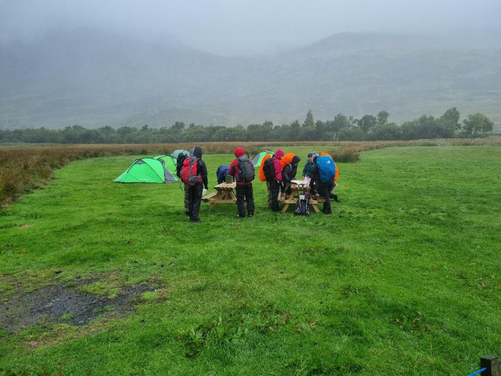
I don't usually take photos of DofE students, but the one below showed no faces as they finished setting up tents.
Area :
Carneddau
The Carneddau (lit. "the cairns"; Carneddau is a Welsh plural form, and is sometimes anglicised to Carnedds) are a group of mountains in Snowdonia, Wales. They include the largest contiguous areas of high ground (over 2,500 or 3,000 feet (910 m) high) in Wales and England, as well as six or seven of the highest peaks in the country—the Fourteen Peaks. The range also encloses a number of lakes such as Llyn Cowlyd and Llyn Eigiau, and the Aber Falls waterfalls. It is delimited by the Irish Sea to the north, the Conwy valley to the east, and by the A5 road from Betws-y-Coed to Bethesda to the south and west. The area covers nearly 200 square kilometres, about 10% of the area of Snowdonia.