Route - North Side of Val Gardena – Orientation day
Head North towards Juac Rifugio on route 17a through forest with gently gradients. Stopped after 3.2k at Juac Rifugio for locally pressed apple juice. Take in views of Selva and surrounding mountains, prominent Sassolungo Massif.
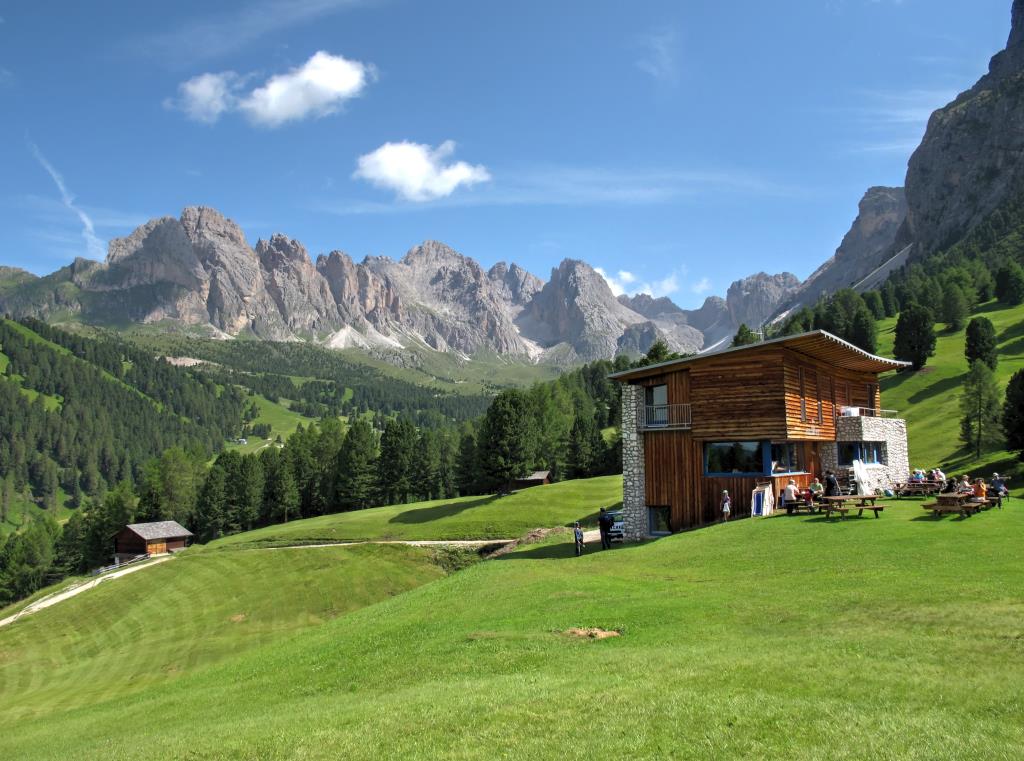
Head on Rote 1a towards Gamsblut Rifugio 1952m. Take lunch here, highly recommend the Kaiserschmarrn or Kaiserschmarren a shredded pancake, which has its name from the Austrian emperor Franz Joseph I, who was very fond of this kind of fluffy shredded pancake.
After lunch we slowly descended on route 20 contouring the southern flanks of Bosch de Freinines at 1850m, eventually descending to St Christina Village with wonderfully picturesque church, the oldest parish church in Val Gardena.
Finally take the gently inclined path of the old railway back to Selva.
Notes
Rifugio Gamsblut
(“Gams” is the German word for “chamois”)
The Val Gardena Railway was constructed, when the region was part of the Austrian-Hungarian Monarchy. In its 44 years in which it was operating, it strongly influenced the valley. The railway was running from 1916 to 1960 and was completed in record time. In fact, construction was started in September 1915 and in February 1916 the railway was officially inaugurated. 6.000 Russian soldiers who were prisoners during the World War did this great work.
Navigation
Maps-Kompass 1:25000
-No 616
GPS-Garmin 64st (loaded with ‘Talky Toaster’ ALPS OSM Base Map)
Android-Samsung S4 Active with Alpine Quest APP
Weather
Morning -Sunny intervals, light wind good visibility
Afternoon -Showers, Thunder & Lightning
Ground Conditions
Dry underfoot, some streams, rivers swollen from previous day rain
Time
Length: 14.4km
Total Ascent: 627m.
Total Descent: 664m
Highest Point: Gamsblut Rifugio 1,952m
Time: approx: 6hrs 50mins.
Group – HF Trek Leader, Myself (Assisting Leading) 8 Adults