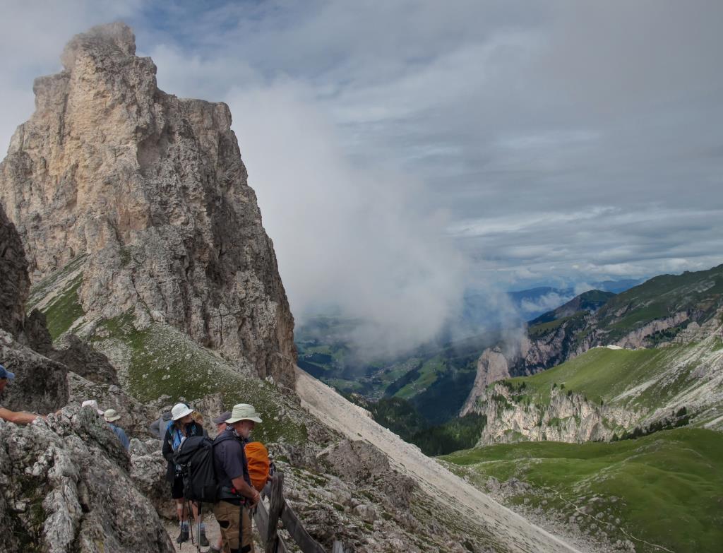
Route – Vallunga, Sas Ciampac & Puez Hut
Took the 2 stage lift from Selva via Panorama to Dantecepies Rifugio 2298m. Set off on Route 12a to Jimmi Hut. Then route 2 starts to climb and weave round dramatic spires to 1st col then descend and climb again to 2nd col, magnificent views of hanging valley Val Chedul high up in the Dolomites. From 2nd Col identified with impressive carved wooden cross, depending on the weather the option here was to either take the lower route that circumnavigates the Vallunga Valley below or climb to the summit of Sas Ciampac 2672m. As the weather was relatively good with occasional low cloud we chose to climb to the summit on route 2a. Descending path eventually joins back up with route 2a, and continues to Rifugio Puez 2475m. Her we took lunch and bought and Ice Coffee. Replenished we continued on route 2 then descnd towards the valley via route 16. On the valley floor this then meets with route 14 back to Selva.
Option – Another beautiful hike, best done in good weather to fully appreciate the views.
Notes
Only one realistic escape route if weather conditions deteriorate via route 14a before reaching Puez Hut.
This hike takes in a section of the GR Alta ‘Via Delle Dolomiti’ well worth doing.
Navigation
Maps-Kompass 1:25000
-No 616
GPS-Garmin 64st (loaded with ‘Talky Toaster’ ALPS OSM Base Map)
Android-Samsung S4 Active with Alpine Quest APP
Weather
Morning -Sunny intervals, light wind good visibility
Afternoon -Showers in the afternoon
Ground Conditions
Dry underfoot, some streams,
Some difficult broken ground and scree to summit.
Time
Length: 17k
Total Ascent: 710
Total Decent:1267m
Highest Point: Mountain Peak Sas Ciampac 2672m
Time: approx: 6hrs 50m.
Group – HF Trek Leader, Myself (Assisting Leading) 8 Adults