Ecuador: Volcan Yanaurco at 4,535m
Weather: Cooling as we climb higher into the Pinan Paramo
Route: Day 1, Tuesday
Pinan Trek
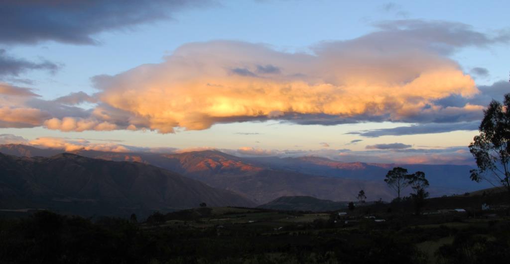
Leaving Pantavi was a real struggle, but we needed to get some serious miles and altitude under our feet. The Pinan Trek is a pretty good acclimatisation circuit. Starting from the village of San Francisco 2,500m we slowly climb towards our first camp at 2,900m the lower reaches of the true Paramo. The landscape slowly changes, gentle slopping fields terminate at gaping ravines. Our tents have been set up ahead of us. We relax and take in the view across towards Imbabura, the setting sun lights up the clouds. A pretty cosy night as we are eased into tent life, first time into the sleeping bags on this trip.
Day 2, Wednesday
To Yanacocha Lake
A big lazy breakfast prepares us for the 6-7 hour walk ahead to our next overnight camp at Yanacocha Lake. A few months ago I was marshalling a challenge event on Snowdon, one other marshals had been to Ecuador before so I interrogated him for a bit of 1st hand reliable beta. ‘What’s it like then’ I said, ‘we’ll’….he said, ‘it’s a bit like Wales’ oh fair enough. Not much point in going all that way then. I was starting to see what he meant. As we climbed higher into the Paramo the tufted rolling grass terrain certainly reminded us of the Eastern Carneddi. The only giveaway being the massive white coned Volcanoes on the horizon.
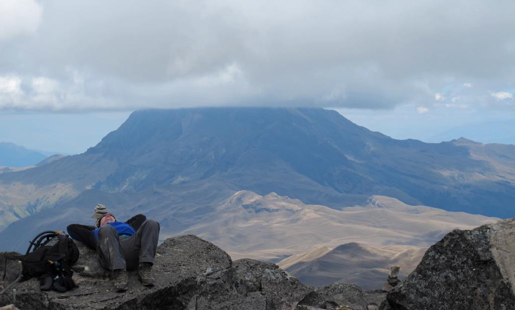
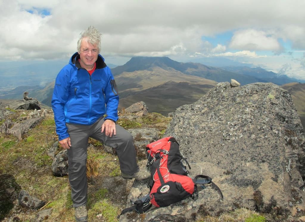
At around 3,900m we take a break, on cue, a Condor appears. I think we’ve just been quite lucky there….with only a few hundred pairs left. Another half hour takes us to the pass at 4,000m from here we can se the next camp at 3,930m aside Lake Yanacocha. Above us drifting in and out of cloud is the rocky outcrop of Volcan Yanaurco at 4,535m. The temperature drops and the stars come out brrrr… duvets jackets on.
Day 3, Thursday
Climb Yanaurco
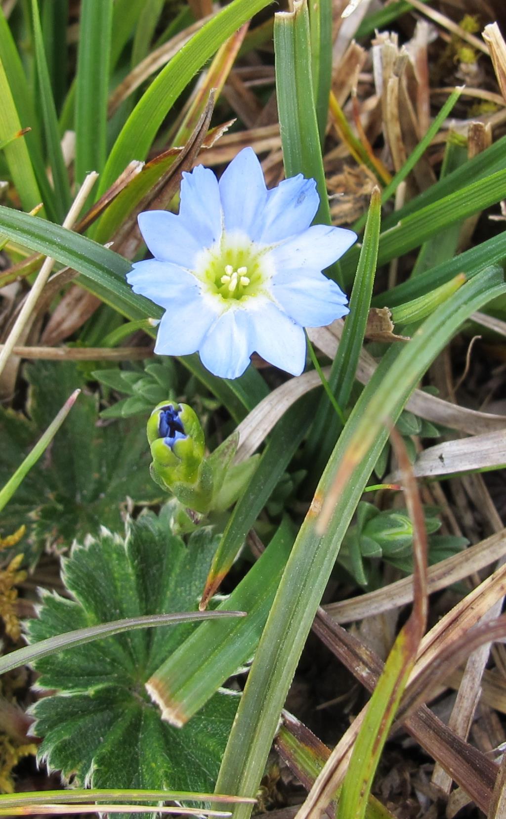
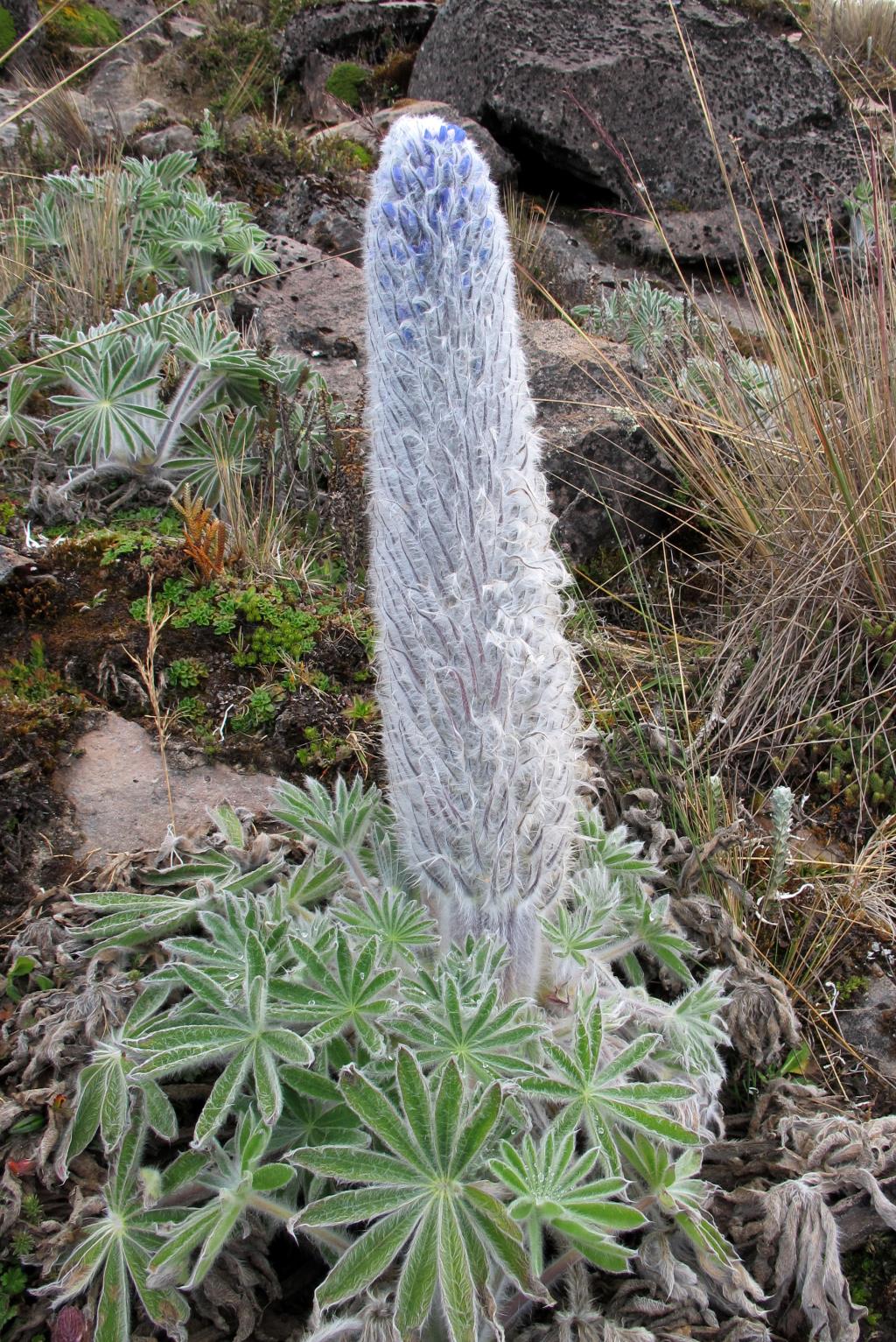
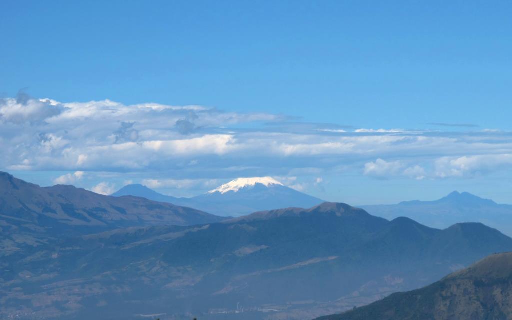
Rise early and head round the back of Yanacocha Lake no particular path, the tussock grass lands hard on the ankles. Eventually we are almost 180 degrees to where we camped last nigh, with a stiff climb ahead of us. The grassland gives way to rock and patches of hi altitude lupines, each flower head still clinging to the morning dew. The last few metres are a scramble but well worth it. We emerge on a small summit roof garden plateau, the wealth of plant life astounding. At 4,535m the view is breathtaking; this is a solitary peak with grand vistas in all directions. To the South, volcanoes Cotacachi 4,939m and Imbabura 4,609m, between the two in the far distance, the perfect pyramid of Cotopaxi, our final destination. Just to the left of Imbabura lies the White mass of Cayambe. In the West, the greater Paramo and Pacific. To the East, final ranges of before the rain forest. A perfect place for a bite to eat, and just tucked down sheltered between the eroded gullies a chance for a quick kip. A brief chill breeze reminds us that we still need to descend. Some hours later we are back at the lake campsite. A great day is finished of with a light drop of mulled wine, and a good night’s sleep. Our burrows however are in party mode.
Day 4, Friday
The eversolong descent from Pinan, and a hot bath
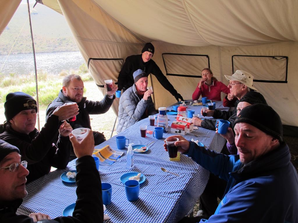
After breakfast we sort the tips out for the camp chef, and head cooks, also the mulers, of which, we seem have more of than what we started with. They have done great job, first class tasty meals something that can be missing from treks.
We head off across the paramo towards Cayambe in the distance, which I guess is approx South East. Soon the Paramo runs out, our last glimpse is of two Chagra (Ecuadorian cowboys) watching from a high tufted hillock, with a stiff pull on the reign they turn and disappear only to reappear a few minutes later half a mile away on another grassy knoll. Were being tracked!!!
The trail heads down….down….down…on and on. With every 100m the temperature rises and the noon sun beats stronger. Soon we get a brief respite from the heat, from the shade of the pine forest an a few cooling streams. Soon the trail opens out again into farmland and low hedges, more sun. Eventually we can see the trail end. On our last legs we trudge into a small hot spring spa near Chachimbiro. With steaming feet we collapse against a shaded wall. They sell beer and pop. The Pools look inviting but we need a bit of cool before we venture in. 3 pools in total, Cold, Hot and 3rd degree burns. First the Hot with a cool beer, then we brave the cold which after the first scream ain’t so bad, probably UK swimming bath temp. The super hot pool is just mental, it has warning signs saying ‘anyone with a heart condition should not immerse for more that a few minutes’. A couple of our group have a dance with ladies from a local keep fit club. Their excess energy is a pleasure to watch. Back on the bus we buzz back to our beloved Hacienda Pantavi in Tumbabiro. Another first class meal (Think it was a steak) a few beers, clean sheets and a soft bed.