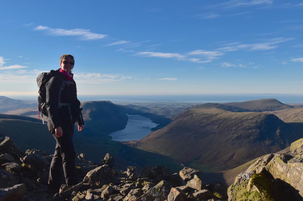
I began from Honister YHA car park and headed up the dismantled tramway path to Drum House where I turned South over Fleetwith and along the easy footpath to a dog friendly stile beneath Brandreth at NY212121. The stile was on quite a lean which made it a bit interesting! I was up there very early so the sun was only a little way up in the sky, it created some beautiful long shadows and colours. The path was not very visible after this point but I was able to follow it to the unnamed tarns at Gillercomb Head, where I had a cuppa stop. The wind here was very strong so I sheltered behind some large boulders. I really like the stone here. I believe it was created by dacite lava flows. After resting I continued to the summit of Green Gable, where the views were extensive with a hint of cloud inversion to the East. I headed down the badly eroded path to Windy Gap and then, after assessing the strength of the wind I took the decision to continue to the summit. I had escape routes at this point, back the way I had come and also down to the North West to Moses Trod. I carefully climbed up the path, over the area where both hands are needed to safely ascend. Once above this, the path was easy to follow along to the rocky summit. The wind was strong but not difficult to walk in. I paid my respects at the summit memorial, then walked further South to take in the views over Wasdale and Westmorland Cairn, White Napes and Great Napes. Returning to the summit I had lunch, then headed back the way I had come to Windy Gap. I descended the rocks by facing the fellside and climbing down using hands and feet being careful to make sure I had a proper foothold before putting my weight on it. Once I arrived at Windy Gap it was truly that, the wind had increased so much it was literally blowing me along the path. It was very hard to stay upright. I decided to take the escape route to Moses Trod which I instantly regretted as the path was so full of scree the slightest pressure on it sent the scree sliding away. It was almost impossible to make any progress. I was very careful and after around 50m the path improved and I was able to continue without difficulty to the Moses Trod path. I headed North along this, admiring the views, to a stile in the fence at NY209124. I wished to explore the path to Haystacks here which I have never done before, so I turned left and headed NW along the fence line over boggy ground until I reached the main footpath near Blackbeck Tarn. There was a lot of heather and sphagnum moss along this section. From here it was easy to navigate East along the well-trodden path to the dismantled tramway at Fleetwith and back to the car park at Honister.
Area :
Western Fells
The Western Fells form the southern wall of the Buttermere valley and the northern fence of Wasdale. Between the two lies Ennerdale so that in effect the group is the shape of a single horseshoe, each branch about 10 miles in length.
At the head of Ennerdale stands Great Gable. The southern arc of the group travels due west from Great Gable, the main ridge consisting of Kirk Fell, Pillar, Scoat Fell, Haycock and Caw Fell.