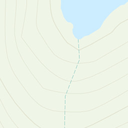
Starting from the Hamlet of Little Arrow on the A593.
Taking the footpath following Torver Beck up to Walna Scar Road, then taking the path to Goat's Water.
Carrying on up to Goat's Hawse, then instead of taking the path on the right, straight to the Old Man of Coniston, I carried on north to Black Crag and then headed south east to the Cairn at 796m. From there, I followed the path south to the summit.
The clag momentarily lifted to reveal spectacular views and photos were taken. The wind had started to increase speed, so I didn't hang around for long.
Retracing my steps for a short while and taking the path on the left down to Goat's Hawse and carrying on up to Dow Crag.
By now the clag had returned and visibility was down to only a few metres.
I then carried on to Buck Pike and Brown Pike where the wind was making it difficult to walk.
Then it was back down to Walna Scar Road and then taking the path back down to Little Arrow.
Area :
Southern Fells (Scafell Pike)
The Southern Fells Include Scafell Pike, the highest peak in England, occupy a broad area to the south of Great Langdale, Borrowdale and Wasdale. High and rocky towards the centre of the Lake District, the Southern Fells progressively take on a moorland character toward the south west. In the south east are the well known Furness Fells, their heavily quarried flanks rising above Coniston Water.