Route
Classic mountain walk, taking in 2 of the Welsh 3,000 peaks. Great views available throughout the day. Good route for quick height gain up the NE Ridge.
From Ogwen cottage take the route through Tin Can Alley to gain the NE Ridge to Y Garn summit, optional excursion approx 850m contour direct up the ridge rather than the defined path on the Llyn Clyd side, topping out turn left to Y Garn summit, good spot for a break with expansive views of Tryfan and the Ogwen Valley. Return back to exit of NE ridge and descend NNW again on defined path that keeps close to edge of Cwm Cywion. On reaching col approx GR SH 62711 60265 Option here to take in Foel Goch summit or take level path that contours 750m to the west of Foel Goch, towards Elidir Fawr. On reaching Bwlch y Marchlyn take a look down onto Marchlyn Mawr reservior and the dam of Electric Mountain. Path from here to summit of Elidir Fawr is occasionaly rugged in places but well defined. Some shelter and spectacular views available from Elidir Fawr Summit cairn.
Retrace path to Foel Goch and either take in summit or continue some way along original route and then attack due East to meet fence at Bwlch y Cywion. Cross Style and progress to find defined path to Llymllwyn Ridge, this provides an excellent final ridge of the day, take care during high winds. Descend approx SSE of ridge again along small but defined path into Cwm Cywion, cross stream at GR SH 63567 60468 and continue on 500m contour below Pinnacle Crag this will eventually return you onto the path that ascends the NE ridge of Y Garn. Return along path taking in Tin Can Alley and finally Ogwen Cottage.
Weather
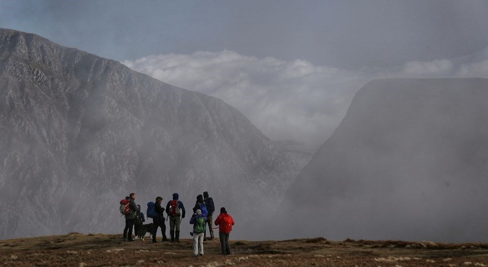
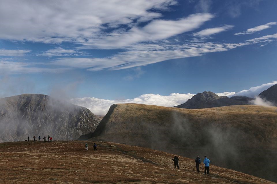
Mild for the time of year, December!! Some small patches of snow remaining cornices and gullies, not impeeding travel. Strong wind from the south west, eased later in the afternoon. Iinversion with cloud rising later in the day.
Ground Conditions
Mixed ground, good trail partially paved up ridge, from there onwelldefined mountail path.
Time
Length: 11.8km Height Gain: 1113m.
Highest Points: Y Garn 947m, Elidir Fawr 923m
Time: approx 6 hrs inc lunch break
Group 12 Persons plus a very capable dog (Sky)
Area :
Glyderau
The Glyderau (a Welsh plural form, also known in English as the Glyders) are a mountain group in Snowdonia, North Wales. The name derives from the highest peaks in the range, Glyder Fawr and Glyder Fach. According to Sir Ifor Williams, the word "Glyder" derives from the Welsh word "Cludair", meaning a heap of stones.