Mountains:⛰️ Moelwyn Bach⛰️ Moelwyn Mawr⛰️ Rhinog Fawr
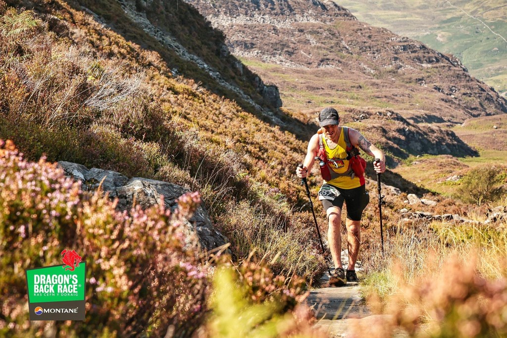
Day 2 of the 2021 DBR was an incredibly tough challenge in the Rhinogs. The heat was relentless, and the clear, sunny weather offered no respite. I’ll never forget how I felt when I first laid eyes on Rhinog Fach—my legs were in bits, and I could feel tears welling up, convinced I had taken on more than I could handle.The route covered 60.61 km with 3364 m of ascent, climbing peaks like Moelwyn Bach, Moelwyn Mawr, and Rhinog Fawr. The terrain was unforgiving, and the heat made every step a battle. Despite feeling completely overwhelmed, somehow, I managed to push through and complete the day.There were moments where it felt nearly impossible, but reaching the valley camp at the end of the day brought a deep sense of relief and accomplishment. This day was a test of sheer determination, and getting through it reaffirmed my resolve to see the DBR through to the end.This Quality Mountain Day was a brutal yet transformative experience, highlighting the mental and physical resilience required to tackle such extreme challenges.
Area :
Snowdon Massif
Snowdon (Welsh: Yr Wyddfa) is the highest mountain in Wales, at an altitude of 1,085 metres (3,560 ft) above sea level, and the highest point in the British Isles outside Scotland. It is located in Snowdonia National Park (Parc Cenedlaethol Eryri) in Gwynedd, and has been described as "the busiest mountain in Britain". It is designated as a national nature reserve for its rare flora and fauna.