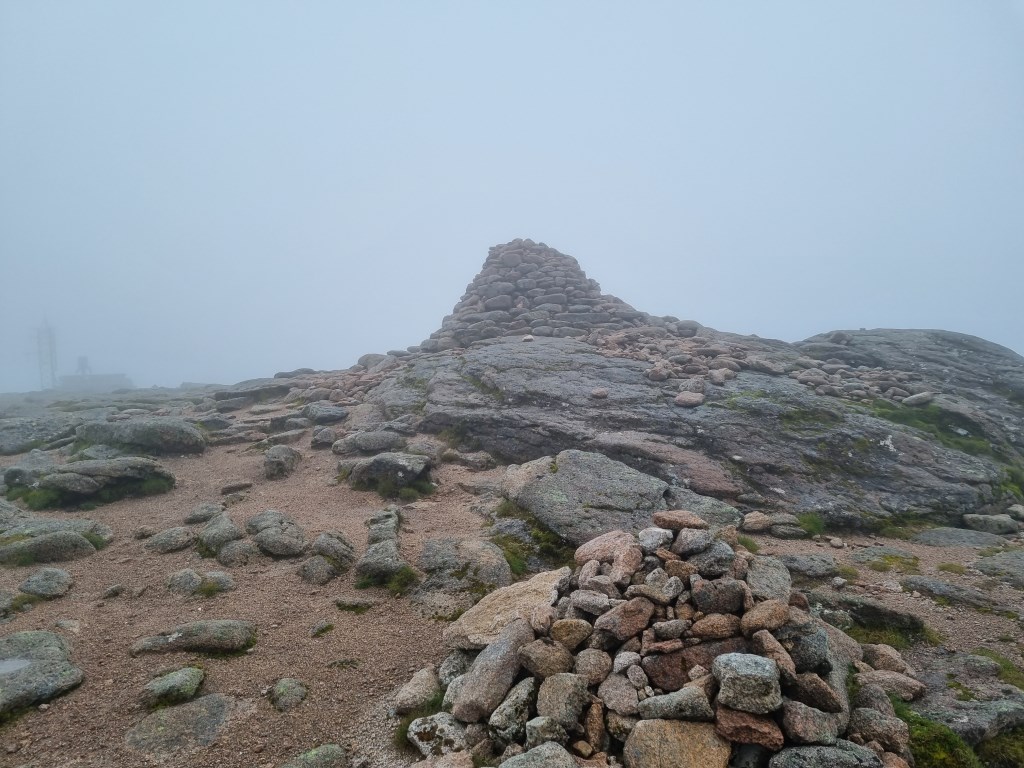
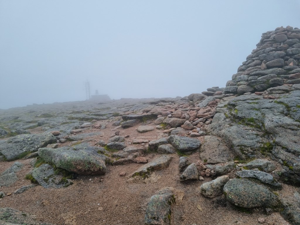
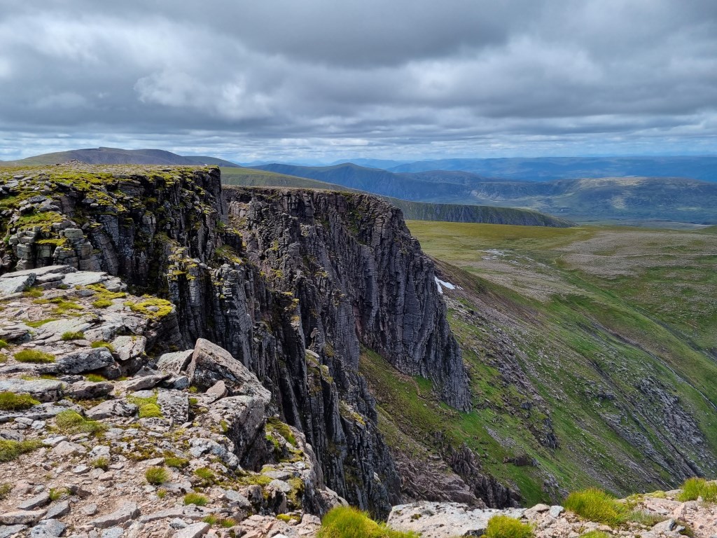
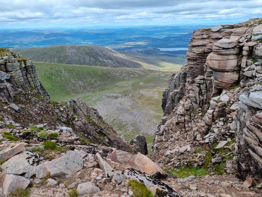
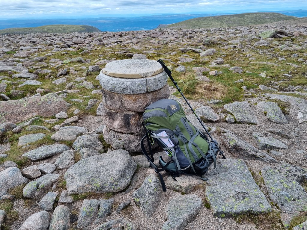
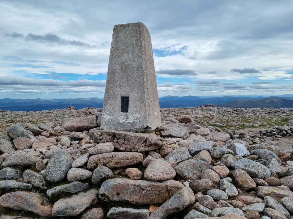
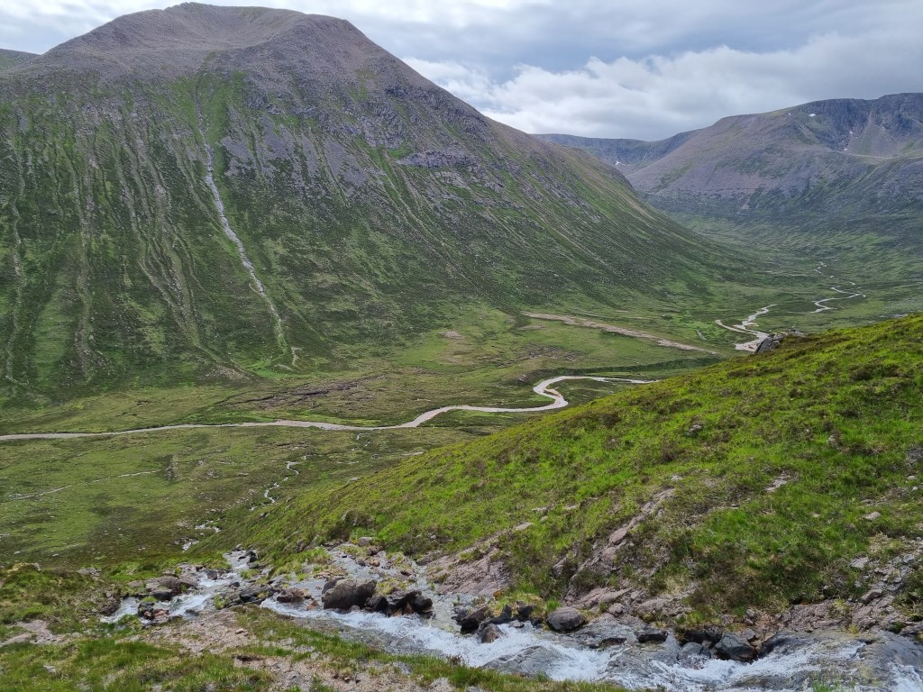
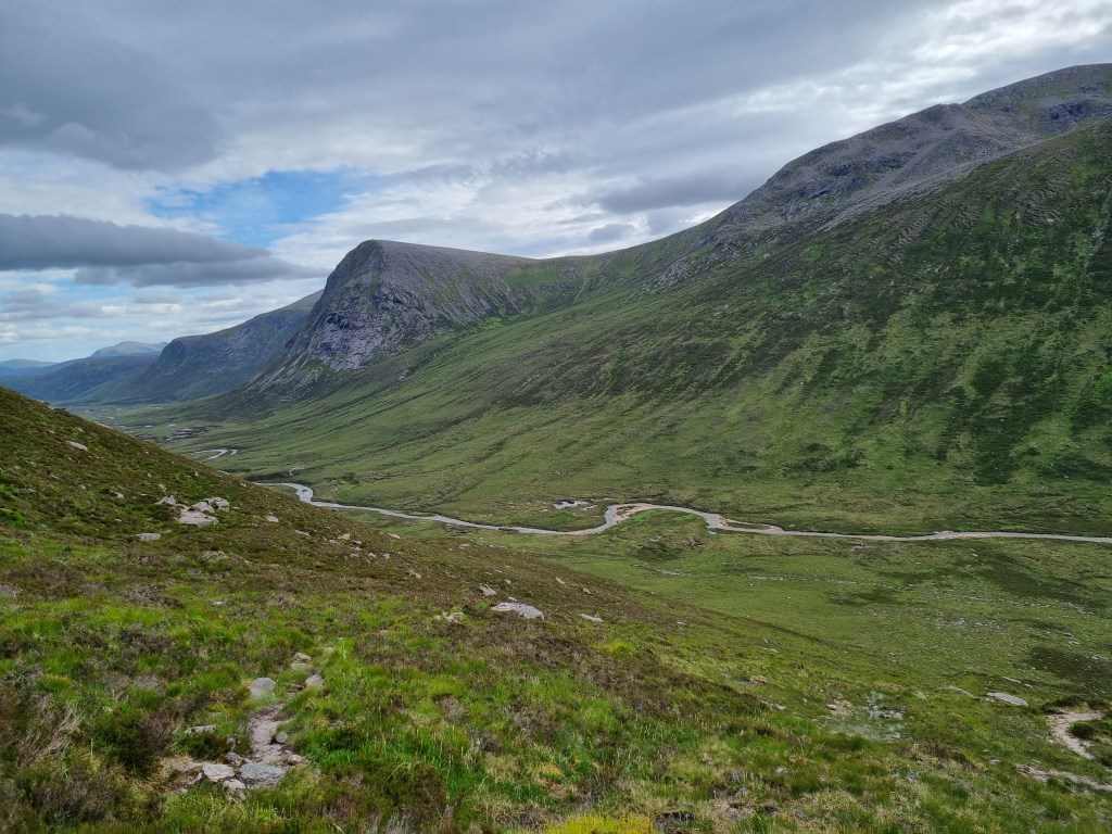
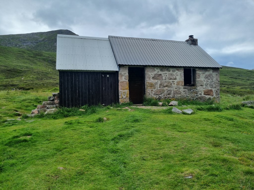
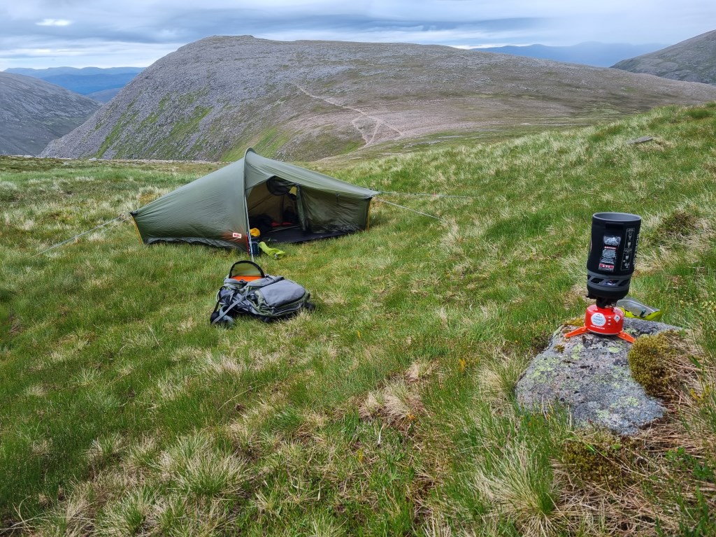
Cairngorm Plateau - 2 day solo journey with wild camp - Day 1 - Started at Cairngorm Mountain Ski Resort parking lot. I had delayed my start because the weather forecast called for rain, strong winds and low visibility on Cairngorm summit until 10AM, then clearing. So I started at 11:00 AM, but the weather had not cleared by then and did not clear until after I reached the summit at around 12:30PM. Arriving at the summit of Cairngorm (1,244m) I hunkered down behind the weather station to block the strong winds and, because of the low visibility and featureless terrain, took a bearing to head in the direction along the ridge line to Stob Coire an t-Sneachhda (1,176m), to Cairn Lochan (1,216m), then turned south to Ben Macdui (1,309m) (second highest summit in Scotland and the UK). The clouds lifted within minutes of my taking the bearing, so visibility, throughout the rest of the day, was very good. After the summit of Ben Macdui I then turned east to top of the massive reentrant at Allt Clach nan Taillear. This decent from 1,249m to the valley floor of Lairig Ghru and the River Dee at Clach nan Taillear (570m) was the most difficult part of the day. A leg burner on the descent with a fully loaded pack. I then walked further south along the River Dee to the foot bridge crossing point at the Corrour Hut. I had planned to wild camp near the hut, but there were several tents set up there so I continued up Coire Odhar looking for a place to set camp for the night. The good point was that there was plenty of water available in the fast descending water fall in in the Coire. However, the terrain was steep and the ground marshy and I got all the way up to the middle of the saddle between Bod an Deamhain (The Devils Point 1,004m) and Stob Coire an t Saigdeir before locating a suitable site. The winds were strong, though visibility was good. Rain was light and sporadic. I found the best site for the tent, based on reducing the wind exposure, the marshiness of the ground, and relative flat ground. Everywhere was wet. Set up camp around 8PM. Made dinner, and since it was still light enough to walk, took in the summit of the Devil's Point (minus pack). The wind was increasing in strength, as was the rain as I got into the tent for the night at around 10:00PM. It became a difficult night as the tent was lashed by wind and rain. I was concerned about water getting into the tent, but through it all I was pleased that my Fjallraven Abisko 1 Lite handled it and everything inside remained dry. The next day I woke in misty cloud, Gale Force winds, and light rain (blowing horizontal, with low visibility. I will continue the journey description for Day 2 in the next DLog.
Total Time: 9 hours 10 minutes; Total Distance: 18.8km; Total Ascent: 1.875m
Weather: Reviewed weather forecasts from Met Office 'Specialist Forecast' for Aviemore and Cairngorm summit. Also tracked MWIS forecast and the regular 'Fleeting View' reports. A review of the Synoptic Charts showed a low pressure moving across the UK with a High Pressure moving in from the Atlantic. Weather called for morning fog and rain on Cairngorm summit until 10:00AM. It did not clear until after noon, but then visibility became very good.
Navigation Planning: This was an entirely new area for me. Started planning with the OS Maps App on my computer to assess and plan the detailed routes. Printed the route maps and laminated A4 size maps for the journey to leave at home with my wife, and carried them with me. Carried a Harvey Superwalker XT25 1:25000 "Cairngorm & Ben Avon" map as my primary. Also carried and compared a Harvey/BMC 1:40,000 map "Cairngorms & Lochnagar" as backup. I found I used the laminated OS maps (printed in four sections to have the print large enough for good detail) because they were the easiest to use in the strong to gale force winds.
Safety and Risk: I carried my First Aid Kit and my Garmin InReach Mini, with a 'Professional' level subscription. Since I was solo I did not carry my group shelter or blizzard bag as I was carrying a tent and sleeping bag. I also left a copy of the route plan at home with my wife. The ground (rock) under foot was mostly wet from rain and marshy ground, and there was a lot of loose rock and boulders to scramble over, and a regular steep descents. Care and attention to footing was important. I have also started carry and use walking poles. Risk was assessed as Low during planning, but I would say in hind sight it was Moderate when scrambling over boulder fields of wet rock in low visibility. Extra care was taken.
Area :
The Cairngorms
The Cairngorms are ‘a little piece of the arctic in Scotland’ according to the SMC Munros Guide and the area contains many of the tallest peaks in the East Highlands. Ben Macdui (1309m), Cairn Gorm (1244m) and Braeriach (1296) are probably three of the better known and the whole area is full of steep corries and high plateaux. Access to the mountains is typically from Aviemore or Braemar.