Day 3 of 3 days as Leader/Trainer for DofE Gold Expedition Training for Edge Hill University students (18/19 years old police officer trainees). As a qualified DofE Expedition Supervisor/Assessor I provided training in navigation, including route planning, map reading, map symbols, use of compass, taking bearings, terrain identification using contours and comparing to what is seen on the ground, pacing and timing, and supervised the walk for the day. An ML and a staff member took a group of 4 boys, and myself a staff member, and another ML took a group of 5 girls. On this day (Day 3) winds were reduced from the previous 2 days gale force winds. Still strong and gusting, but today we went to higher ground circumnavigating Tryfan. Though the attitudes and willingness to take on the challenge of higher ground in wind and rain, the group did suffer from a lack of fitness by most of the members. I emphasized that by the time they return for their Gold Assessment next May that they need to improve their fitness.
Camped at Gwern Gof Uchaf camp site at base of Tryfan on nights 1 and 2. For this morning they packed all of their gear, including tents and Trangia's, and carried them all day. They were setting up and taking down tents in strong to gale force winds and heavy rain.
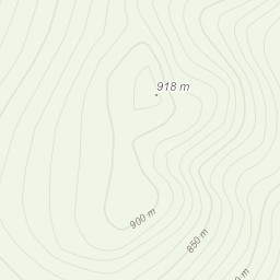
Route Planning: I plan my own walks in advance using OSMaps App on my computer, printing A4 map sections that cover the planned terrain. In this case, though we knew the general area in advance I conducted detailed planning on the ground at the site after we knew the group size and had assessed the capability of the group, and combined that with the weather at the moment. After determining the route for my group I had the students develop a Route Card for the walk. .gpx file loaded below.
Weather: Weather reports were reviewed from the Met Office and MWIS, as well as XCWeather (which provides a volume of rain rather than percentage of probability). Non of the weather reports reflected what we actually experienced in the Ogwen Valley. Notably, MWIS is Snowden centric, which, with prevailing southwest winds reflects a good general expectation in Snowdonia. However, on this day, strong winds out of the northwest were grabbed by Carnedd y Filiast at the west end of the Ogwen Valley like a hook that squeezed and squirted the winds and rain up the Ogwen Valley with the winds, though not at gale force as on Days a1 and 2, we still had strong winds and heavy rain.
Risk Assessment: The winds on Day 3 were still strong, but reduced from the previous days gale force winds. There were no water crossings. Ground under foot was boggy and rocks were wet. The ground was also steeper with more elevation gain today. The only issues were a turned ankle by the University member of staff on day 1. He continued to use one of my walking poles for support and was fine with continuing. One of the young women also started to have concerns about a 'dodgy' knee. She used my second walking pole and completed the walk. Progress was very slow.
I don't usually take photos of DofE students, but the one below showed no faces as they finished setting up tents.
Area :
Glyderau
The Glyderau (a Welsh plural form, also known in English as the Glyders) are a mountain group in Snowdonia, North Wales. The name derives from the highest peaks in the range, Glyder Fawr and Glyder Fach. According to Sir Ifor Williams, the word "Glyder" derives from the Welsh word "Cludair", meaning a heap of stones.