Everest Base Camp trek
Weather: Occasionally very cold & very windy.
Conditions on trail:
Dusty trial,lose scree in places,snow field in places.
Group member: 6 Adults plus guides
Day 1 -23rd April
Land at Lukla airport after hairy flight, on route to 1st nights stop Phakding
Day 2 -24th March
Phakding to Monjo
Day 3 -25th March
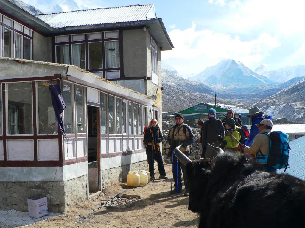
Monjo to Namche 3500m
Day 4 -26th March
Acclimatisation walk higher up to the Namche airfield
Day 5 -27th March
Namche to Tengboche 3867m
Day 6 -28th March
Tengboche to Pangboche 4200m
Day 7 -28th March
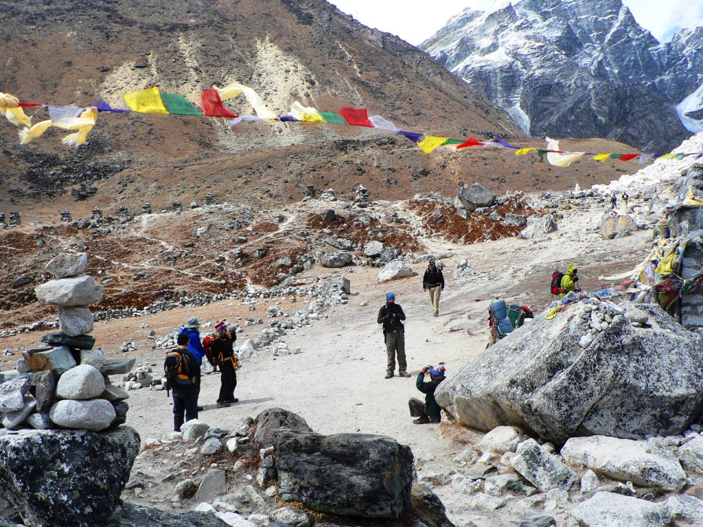
Pangboche to Dingboche 4350m
Day 8 -29th March
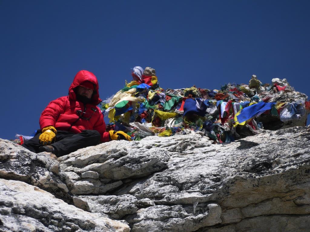
Dingboche rest day at Dingboche to climb Nagartsang Peak 5083m
Day 9 -30th March
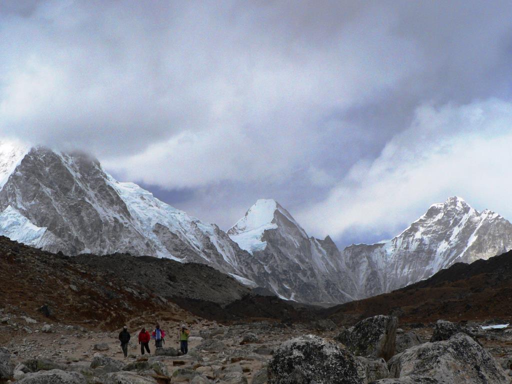
Dingboche to Labouche
Day 10 -31st March
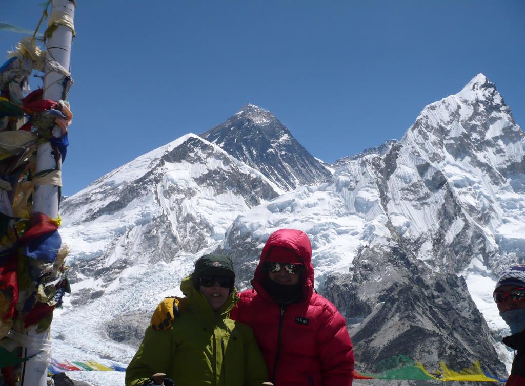
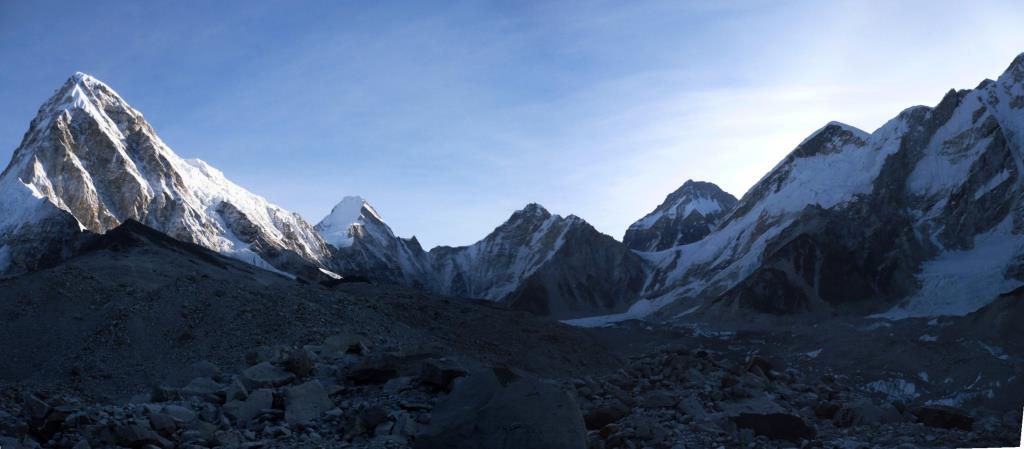
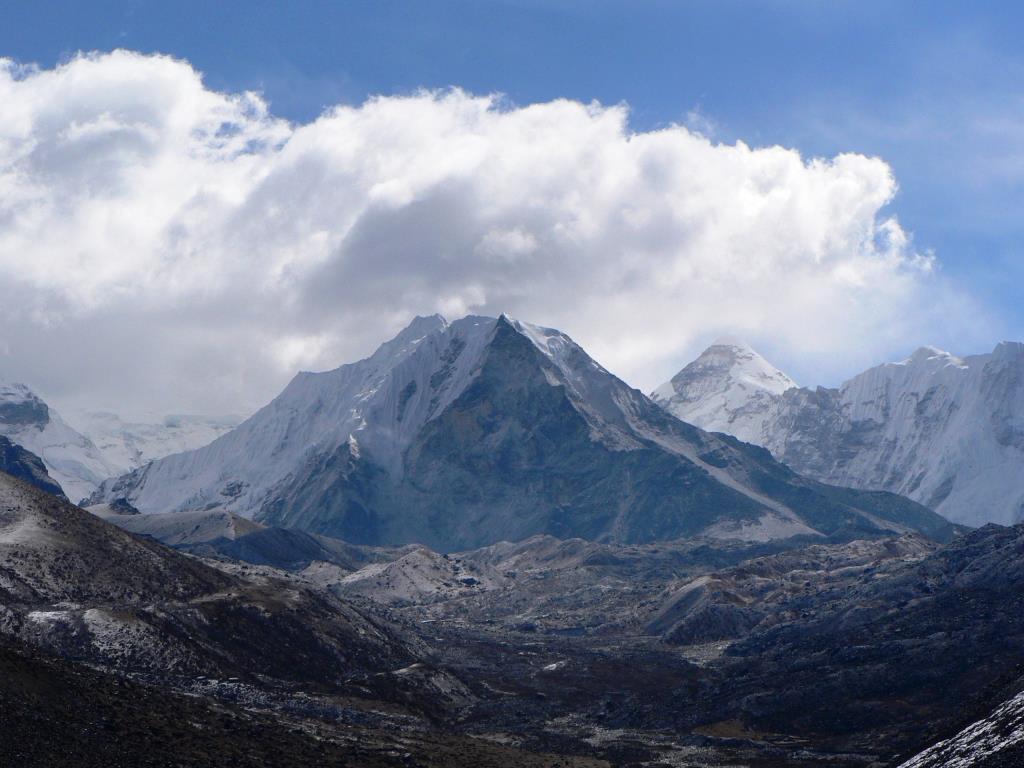
Labouche to Goarak Shep and Kalla Patthar. Base Camp. return to Labouche
Day 11 - 1st April
Labouche to Dingboche then onto Chukhung village, 4,730 metres (15,518 ft)Overnight stay for attempt on Island Peak. Severe storm broke, had to make decision whether to wait it out or descend back to Dingboche.
Day 12 -2nd April
The following day the weather had got worse and the forecast was not good so we headed back to Pangboche to meet up with friends. In hindsight it was a good decision as the weather did not improve for several days.
Day 13 -3rd April
Pangboche to Namche, for a well earned rest.
Day 14 -4th April
Namche to Lukla.
Day 15 -5th April
Another hairy plain ride!!!
A few notes from the trip if your
thinking of trekking near Everest ?
Went to the Nepal Khumbu region back in 2008 so a few of the details below may have changed since then but i thought a few notes might be useful.
This is only intended as quick personal overview but may provide some useful tips and observations.
Getting there
The usual airlines are Qatar, Emirates and the new one Ethiad. Most of these fly from Heathrow to either Dubai, Abu Dhabi or Delhi and then onto Kathmandu. Be warned book early, we wanted to go in late March, we bought tickets in the previous November for approx £550, if we had delayed until December the price went up to over £800.
Flights from Kathmandu to Lukla and return, Get to the Kathmandu airport early, I mean 6.30am, flights go early as soon as there is enough daylight. There can be a scramble for the first flight out, as flights out may get backed up for days due to poor weather conditions.
The flight from Kathmandu to Lukla is an experience in itself.
Leaving Kathmandu don’t forget your departure tax its NR 1700 at the moment.
Money
Current approx rate April 08 122 to 123 NR to £1
Use the non commission agency’s to change your travellers cheques, sterling was ok better than the dollar at the moment, it’s a good idea to get some low denomination cheques for later on in your stay i.e. £20’s as you don’t want to be stuck with too many high denomination Nepali Rupee’s. Money goes quite a long way in Nepal. The higher you go the more expensive the goods as everything has to be brought up by Yak or Porter.
Water in Kathmandu 22 NR, water in Labouche high up in the Khumbu valley 250 NR.
As a guide we took £200 each for a 3 week trip but our accommodation and food were prepaid. £100 each would have been sufficient without buying to many presents.
The relatively prosperous Khumbu valley gives a false impression of the general standards of living in Nepal. Outside the honey pot regions there is real poverty. It’s worth investigating what help you can provide to local communities if you are visiting the more remote areas. A simple example would be that good quality cheap sunglasses are available in the UK, take a few pairs out and pass them onto the kids in the villages where you pass. Every little helps.
Equipment
Most trekkers have know doubt already got most of the kit they probably need for trekking in this region, Down Jacket, Wind block fleece waterproofs etc. If you are short a few items or couldn't bring kit because of weight restrictions, get stuff in the capital Kathmandu the quality is a lot better than it used to be, down gear especially. Gone are the days when the Chinese thought that putting multiple brand labels on the same jacket made it more valuable!
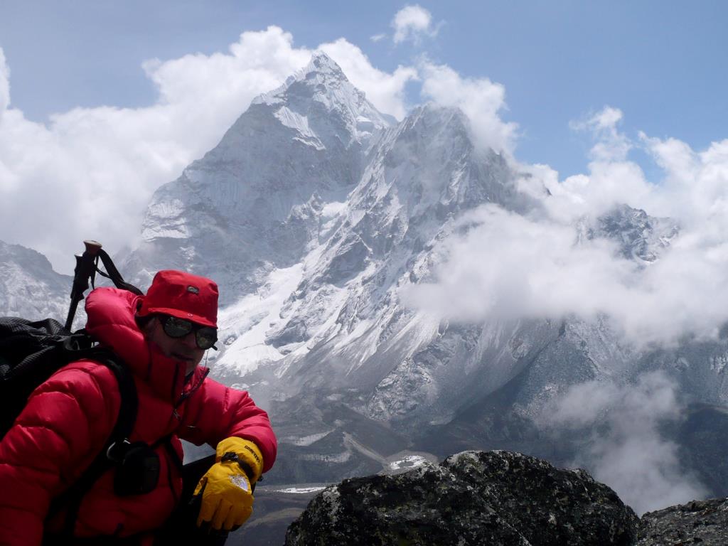
The most popular brands are predictably North Face, Patagonia, Mountain Hardware and Mammut. Berghaus, Rab and Mountain Equipment don’t seem to have been copied yet so you can tell who the brits are. The sun on the snow is very very bright, make sure you pack a pair of good quality full wrap glacier specs
Gear cost Examples
Double skin NF style gloves 800 NR £7 UK approx
Goretex NF trousers 2500 -3000 NR £25 UK approx
Weather
The weather conditions for April 2008 were unpredictable to say the least. March and April would in previous years have been good bets for clear skies but a recent lack of seasonal snow this year locals believe and possibly global warming has lead to some unpredictable conditions. Dress and expect 4 seasons in 1 day. The mornings tend to be the best for clear skies and good visibility (most of the treks for Base Camp etc start well before dawn to get the best conditions) with the cloud and cold winds building in the afternoon. At above 4500m when the sun is out, it is reasonably warm enough to hike with one layer plus it burns easily so factor 50 and lipsalv. As soon as the cloud comes the temperature drops rapidly and the wind is bitterly cold. A Buff or similar neck warmer is extremely useful along with a simple cotton scarf to keep out the dust churned up by the Yak traffic, This dust is a major culprit of the Khumbu Cough as it’s called.
Tip for keeping warm at night….Boil up any remaining hot water and put it in your sig bottle, stick a sock over the bottle and pop it in your sleeping bag, keeps warm for 5hrs if your lucky.
Accommodation and conditions
Most trekkers camp or stay in traditional Sherpa Tea houses or lodges on route, the higher you go the more basic, Namche at 4300m is luxury compared Labouche & Gorak Shep around 5000m.
As the tree line disappears so the wood for the stoves is replaced by Yak poo, very effective for heat but it can be quite nauseous when the wind blows the fumes back down the flu into the rooms. This plus the lack of Oxygen can make for restless nights above 5000m.
The Yaks and Porters have the right of way on the trail. Keep to the inside when they are passing, and beware the Yaks sway wildly with the heavy loads.
Food
Breakfast – Porridge with hot milk Honey & Jam’s pretty good
Lunch – Ra Ra Noodles (sort of Supernoodle without the bits of veg), Tomato or Garlic Soup
Dinner - Dhal Bhat (Rice & Veg), Yak Steaks, Pizza Tom & Tuna, Boiled or Fried Momo (dumplings)
Drink – Black Tea or Chiya is best (the milk can be a bit dodgy) NO ALCAHOL
Canned pops, chocolate bars, trail mix and biscuits available in most villages just check the sell buy dates.
On your return to the smog of Kathmandu it’s tempting to have a few blow out sessions with your last rupees, be warned, the effects on your digestive system of your first beers for weeks and a local curry can be explosive.
Power supply
Most of Kathmandu’s electricity comes from hydro power, as there has been little snow this year, power cuts in the capital are common. Power usually comes on about 9am, goes of at Noon and back on a 5pm for awhile and then goes off again. In the Khumbu Valley its better, as the villages work from local hydro systems. You can charge you camera batteries as most overnight stops approx 350NR per hour. I took a small solar charger for AA batteries and I pods as a back up, worked fine.
Staying Healthy
You probably find that you are continually monitoring your health and that of others during a trek. The most common concern is with stomach upsets. If you follow a few simple rules you should be ok.
Don’t drink the tap water unless it’s been boiled or treated
Do trust the bottled water, check that the cap seal is unbroken
Iodine treated water can also upset you if you have too much
Don’t clean your teeth with tap water or get tap water in your mouth from showers
Don’t have the local milk with cereals or muesli unless you know it is safe
Don’t drink alcohol until you get back
Keep your food intake simple, the Dhal Bhat is good and filling, A Yak steak can sound like a nice change but can be very rich on a stomach that has been used to plain food.
Altitude related illness and Acclimatisation
This is the biggie for most people, and unless you are familiar with trekking at around 5000m it’s hard to know how your body is going to react until you are actually there. Check out the info available on the numerous medical websites.
Most with a general good level of fitness will be ok as long as they are sensible and take it easy.
Not being a doctor it would be wrong for me to give specific info, though here are a few tips that I feel we found useful. Accommodation is always available to fit in with a good acclimatisation program Don’t rush the first few days.
Day 1 -Lukla 2804m to Phakding 2623m (you loose height that day but you feel good)
Day 2 -Phakding 2623m to Monjo (Easy day back up to about Lukla elevation)
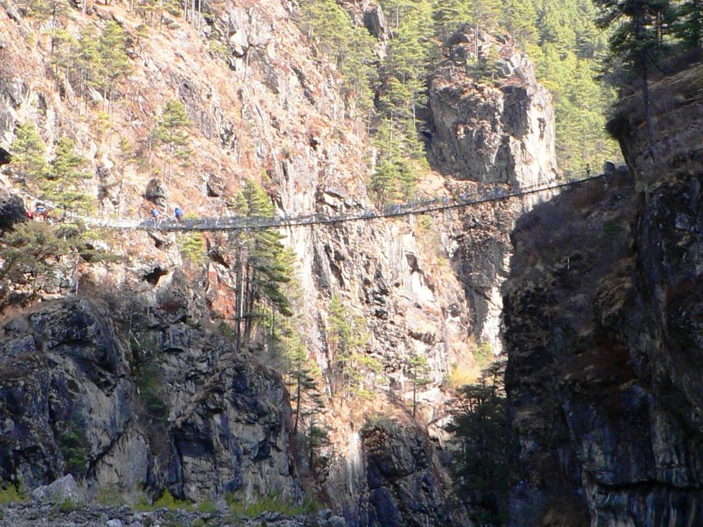
Day 3 -Monjo to Namche 3500m, (For most this is the first hard day, after a trek along the valley floor, and the infamous high level bridge, you climb the steady but relentless switchbacks up to the village of Namche Bazaar.
Trekkers get there first experience of the effects altitude at Namche, it can feel like you are wearing a tightly fitted hat often accompanied by occasional sharp pains. It can be difficult to attribute these symptoms solely to the altitude, as some will also be experiencing symptoms also that can be associated with dehydration.
If your plan is to use Diamox for higher up then some start a course here at Namche , Aspirin also helps. (Take medical advice)
Day 4 -Most take a rest day at Namche but take advantage of an acclimatisation walk higher up to the Namche airfield at Syangboche and Everest viewpoint, sleep lower back at Namche.
Day 5 -Namche to Tengboche 3867m (A long day with a decent back to the valley floor then more switchbacks back up to the monastery village of Tengboche, check out the Monastery and classic views of Ama Dablam)
Day 6 –Tengboche to Pangboche 4200m (A shorter day but you cross the 4000m barrier, take advantage of some short walks in the afternoon higher up around Pangboche
Day 7 – Pangboche to Dingboche 4350m (A longer days walk to one of the main crossroad villages)
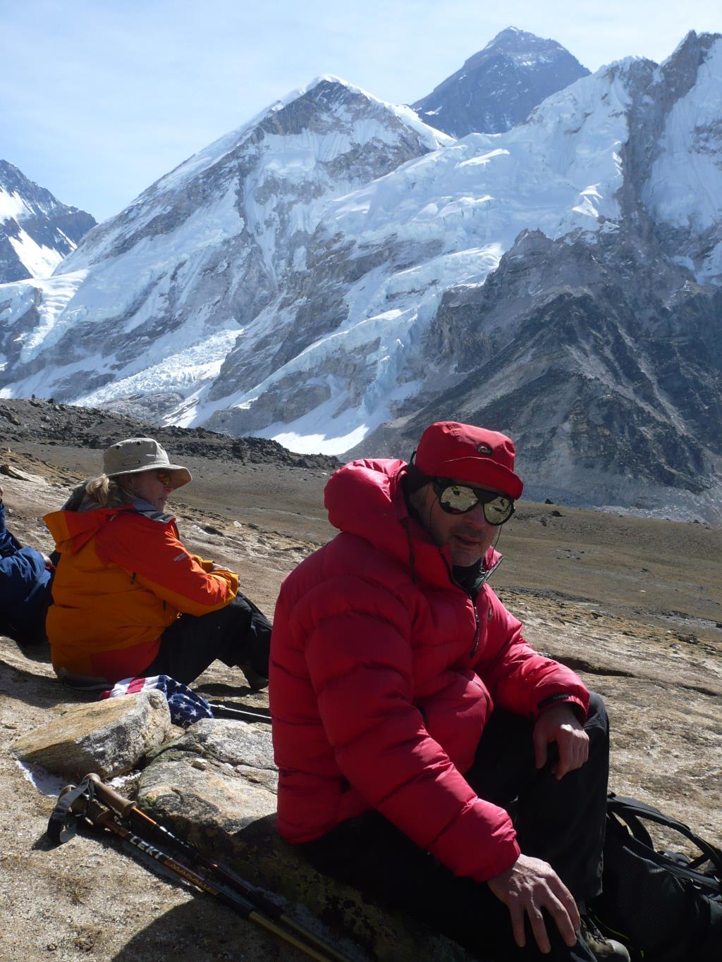
Day 8 – Dingboche and further… Some trekkers use a rest day at Dingboche to climb Nagartsang Peak 5083m above the village, it gives you an idea of you abilities above 5000m plus a cracking view of Ama Dablam and the further valleys ahead.
Anything beyond here is up to you as the valleys and trails break North to Everest Base Camp and East to Island Peak, monitor you ascent rates carefully and keep an eye on other members of your group.
If you have access to a blood Oxygen monitor and know how to use it this is also a useful tool. Take out adequate insurance before you leave, we used the BMC trek insurance. See your GP before you go tell them what you propose to do and get the required vaccinations. The Malaria vac is not usually required for the Everest region unless you are planning to go to Southern Nepal later on.
The End bit
Above all remember your supposed to be having fun and experiencing the trip of a lifetime. Nepal rarely disappoints, and the people are fantastic.
The elections were on whilst we were in Kathmandu, the Maoists were elected as the majority party of government. Difficult to say how it will affect the country at the moment, but the first few days post election appeared stable. Worth checking the news websites pre departure. Most Nepali’s we spoke to were not overly interested in the turmoil’s of their political system, more concerned about getting on with business of making a living.
Nameste, as they say