Robin Shaw - 108161

logs 311

Awards Completed

RCI ML
Member Of

Walking Record

Details

Date : 25/11/2021

Duration : 5-8 hours

Style : Equals

Type : Mountain Walking

Weather : Cloudy - Poor Visibility

Wind : Moderate Wind

Camping Type : N/A

Nights Camping : 0

Mountains : Arenig Fawr

Flagged :

Description

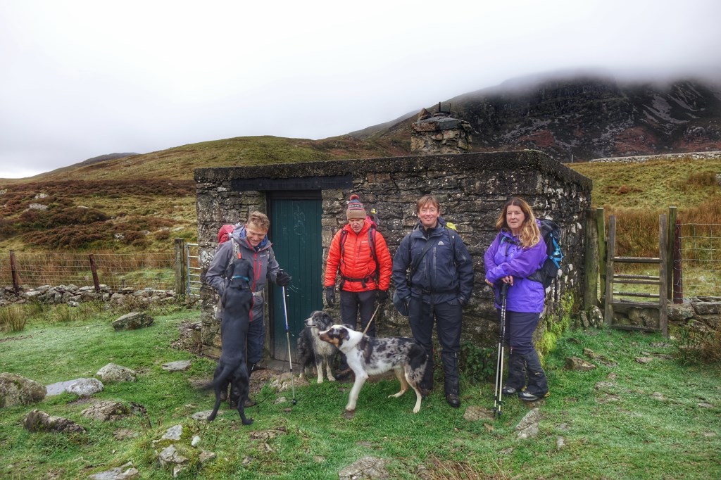
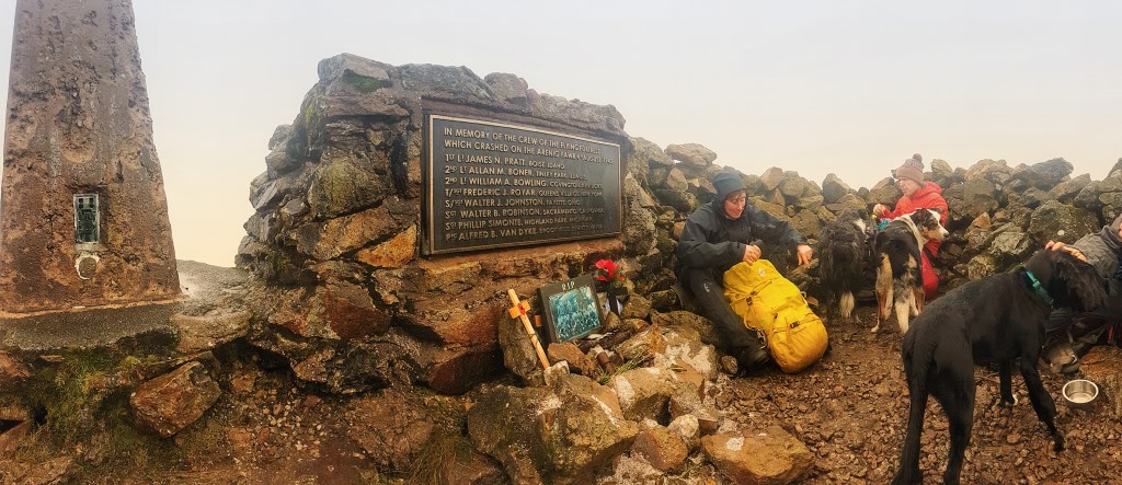
Location - Arenig Fawr
Date - 11/11/2021
Weather - Cloud level around 600-700m, occasional rain
Route - Remembrance day walk to summit and WW2 memorial. Standard route from B Road to the north via Bothy and Y Castell to summit, original decision to return via circuit to Moel Llyfnant changed due to excessively boggy ground. In spite of the weather a great days walk with the dogs.

Area : Arenigiau Range

Ofter refered to as Arenigs, which is an informal term for a group of mountains in central Snowdonia, in north Wales.

Map

MarkerMarker
Leaflet Tiles © Esri — Esri, DeLorme, NAVTEQ, TomTom, Intermap, iPC, USGS, FAO, NPS, NRCAN, GeoBase, Kadaster NL, Ordnance Survey, Esri Japan, METI, Esri China (Hong Kong), and the GIS User Community
Distance : 10.01 km

DLOG Friends

Join an association to be able to add DLOG friends.
click here to learn about premium accounts

Images

Loading